Revolutionizing Vineyard Irrigation with Aerial Data
A New Era for Sustainable Vineyard Management
By Michael Joseph | CTO @ One Kappa
- 4 min read
Revolutionizing Vineyard Irrigation with Aerial Data
Key Takeaways
- A groundbreaking approach to vineyard irrigation leveraging aerial data.
- Explore the transformative impact of aerial insights on sustainable vineyard management.
- Discover the future of vineyard technology and its implications for the wine industry.
Introduction
In the heart of modern agriculture, vineyards stand as a testament to the art of winemaking. Behind every exceptional wine is the meticulous care of vineyard management. Recently, a pioneering approach has harnessed the power of aerial data to usher in a new era of vineyard irrigation strategies. In this comprehensive article, we delve deep into the cutting-edge developments in vineyard management and how aerial insights are transforming this age-old practice.
The Impact of Aerial Data in Vineyard Research
Precision Agriculture Redefined
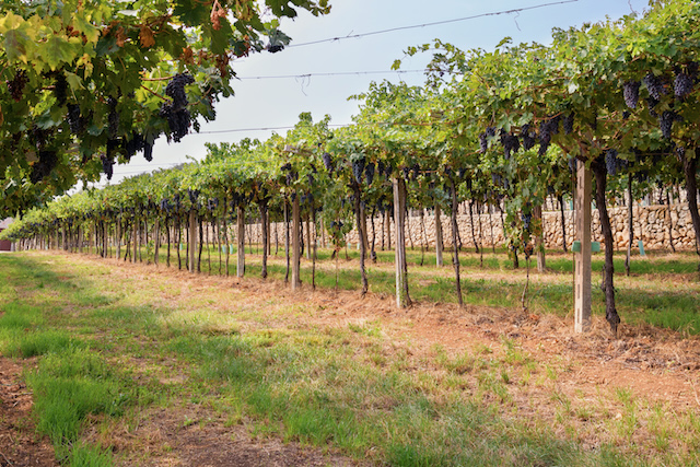
Traditionally, vineyard management relied on manual observations and labor-intensive practices. However, the integration of aerial imaging and data analysis has redefined precision agriculture in the vineyard sector. Aerial data, acquired through drones and satellites, provides vineyard managers with a bird's-eye view of their vineyards. This vantage point allows for a comprehensive assessment of vine health, canopy development, and soil conditions.
With this newfound precision, vineyard researchers can develop irrigation strategies that are tailored to the unique needs of each vine. Gone are the days of uniform watering; now, every drop of water is strategically deployed to maximize vine health and grape quality.
Identifying Stress and Disease
One of the most remarkable applications of aerial insights in vineyards is the early detection of stress and disease. Unhealthy vines exhibit subtle signs that are often imperceptible from ground level. Aerial imaging technology can detect these signs at an early stage, enabling swift intervention to prevent the spread of disease and ensure the well-being of the vineyard.
The ability to pinpoint stressed vines also enhances resource allocation. Instead of uniformly irrigating the entire vineyard, resources can be directed precisely where they are needed, reducing water consumption and promoting sustainability.
Soil Health Monitoring
Aerial data doesn't stop at vine and canopy analysis; it extends to soil health monitoring. Understanding soil conditions is fundamental to vineyard management. Aerial imaging can provide valuable insights into soil moisture levels, nutrient distribution, and compaction issues. Armed with this information, vineyard managers can make informed decisions about soil amendments and irrigation scheduling.
Sustainable Vineyard Management
Environmental Stewardship
Sustainability has become a paramount concern in modern agriculture, including viticulture. Aerial data-driven vineyard management aligns perfectly with sustainable practices. By optimizing irrigation and resource allocation, vineyards can reduce their environmental footprint while maintaining or even improving crop yields.
The ability to monitor soil conditions and moisture levels remotely also minimizes soil compaction caused by heavy machinery. This, in turn, promotes healthy soil ecosystems and preserves the long-term fertility of vineyard soils.
Cost Efficiency
While adopting aerial data technologies may require an initial investment, the long-term cost efficiency is undeniable. Reduced water usage, labor, and the prevention of disease outbreaks translate into significant cost savings for vineyard operations. These savings can be reinvested into further research and development, improving overall vineyard productivity.
Enhancing Grape Quality
Aerial data not only benefits the sustainability and efficiency of vineyard management but also plays a pivotal role in enhancing grape quality. The ability to tailor irrigation based on aerial insights ensures that each grape receives the optimal amount of water and nutrients. This precision leads to improved grape development, flavor, and sugar concentration, all contributing to the production of high-quality wines.
The Future of Vineyard Management
As we look to the future, the role of aerial data in vineyard management will only expand. Innovations in sensor technologies, artificial intelligence, and data analytics will further enhance our ability to monitor and optimize vineyard conditions. The quest for sustainable practices and premium grape quality will continue to drive technological advancements in the vineyard sector.
Sensor Technologies
Advanced sensor technologies will provide real-time data on various vineyard parameters, including temperature, humidity, and pest presence. This data will enable vineyard managers to make proactive decisions, ensuring the health of their vines.
Artificial Intelligence Integration
Artificial intelligence will play an increasingly crucial role in vineyard management. AI algorithms will analyze vast datasets from aerial imagery and sensors, providing actionable insights and predictive analytics. This will revolutionize decision-making processes and lead to even more efficient resource allocation.
Data Analytics for Precision
Data analytics will continue to evolve, offering even more precise recommendations for vineyard tasks. From pruning to harvesting, data-driven insights will optimize every step of the winemaking process.
Conclusion
In conclusion, the integration of aerial data into vineyard research and management is revolutionizing the wine industry. Aerial insights enable precision agriculture, early disease detection, and sustainable practices that benefit both the environment and the bottom line. As technology continues to advance, vineyard researchers and managers can look forward to even more innovative solutions that enhance the art and science of winemaking.
Vineyards, once steeped in tradition, are now embracing cutting-edge technology to produce wines of unparalleled quality, all thanks to the transformative power of aerial data.
One Kappa Eagle Eye
Unlock the power of precise imagery with Eagle Eye! Access low-cost ultra-high resolution imagery through our user-friendly web application.
Get Imagery